Category Archives: Walking

Westmorland Park

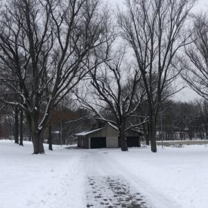
Westmorland Park shelter on December 31, 2021

Westmorland Park on December 31, 2021

Westmorland Park is another City of Madison park. The official address is 4114 Tokay Boulevard, which is four or five blocks east of Midvale Boulevard. It’s a relatively small park, bounded by Tokay Boulevard, Gately Terrace, Park Lane and St. Clair Street.

While it is a small park, there are basketball and tennis courts, some walking paths, both paved and unpaved, and a very nice shelter. In the winter there is a skating rink and there are some small hills that are suitable for sledding.

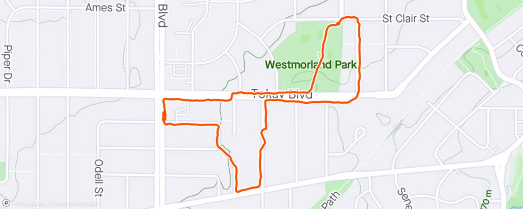
I enjoy walking in the Westmorland Park neighborhood a lot; the parkj is very nice but kind of small, but the neighborhood is just a nice place for a walk. Here is a map of one of my recent walks:

Walking route near Westmorland Park on 2021-12-31.

I usually park near Midvale Community Lutheran Church and then I walk down Wakefield Street to Leeds Street, and from there I take one of the walkways to Chatham Terrace. On this walk I took the walkway towards Odana Road. From Odana Road, I walked down to Anthony Lane and from there to Tokay Boulevard. Then I just followed Tokay to Park Lane, passing Westmorland Park on my left.

Just before crossing the street to walk up Park Lane, Tillotson Park is on the right. It’s really more of a neighborhood green space than a true park, but there is a path that leads to the Southwest Commuter bike path.

After walking up Park Lane and turning left onto St. Clair Street, the park is just on the left. There’s a nice paved path that leads through the park, past the shelter and ends at Tokay Boulevard. From here I just walk back along Tokay to where I parked the car.

Marion Park in Prairie du Sac

Marion Park is in Prairie du Sac, though it is only a block or two from Sauk City. The land for the park was donated to the village of Prairie du Sac by Mr. & Mrs. W. H. Jacobs in 1894 and the park is named in honor of their daughter Marion. The official address of the park is 145 1st Street, and it sits on a large block that is bounded by 1st Street, Grand Avenue, 5th Street and Lincoln Avenue. Grand Avenue Elementary School is on the block adjacent to the park, and a public outdoor pool is on the corner of Grand Ave and 5th Street. The old Sauk Prairie Hospital  it kitty-corner from the park, at 1st Street and Lincoln Ave.

The park has a disc golf course, shelter house and other amenities. It’s probably most famous for being the site of the annual Wisconsin State Cow Chip Throw & Festival on Labor Day weekend. I usually run in the Cow Chip 10 K race every year.

Here is a typical walking route:

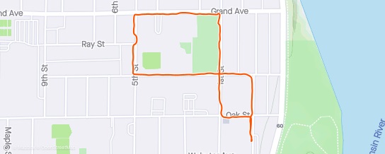
Walking route in Marion Park on 2021-02-28

I usually park in Sauk City on Helen Street by the parking lot for the old hospital. I walk on Helen Street to Oak Street – Oak Street is the dividing line between Prairie du Sac and Sauk City. I head west on Oak Street for a block until I get to Washington Street (Sauk City) or 1st Street (Prairie du Sac) and I turn right and walk past the old hospital to Marion Park. On this walk I just walked around the boundary of the park beginning at the corner of 1st Street and Lincoln Ave and proceeded counterclockwise. When it’s not winter, there is an available paved path from 1st Street to the shelter house and then to the playground area behind Grand Avenue School.

Note that not all of the streets have sidewalks on both sides! When I got back to the starting corner, I walked down Lincoln Ave to Helen Street and then headed back to the car past the old hospital.

The total distance is about 1.2 miles.

Rennebohm Park

Rennebohm Park is another City of Madison park. Its official location is 115 N Eau Claire Avenue. Its is sort of a long and narrow park that is bounded by N Eau Claire Avenue, N Segoe Road, Regent Street and a series of apartment buildings that face Sheboygan Avenue. The Sheboygan Community Garden is in the park, along with a shelter house that is accessible from N Eau Claire Avenue.

The park is named after Oscar Rennebohm who served as lieutenant governor and governor of Wisconsin and later served on the UW Board of Regents. He died in 1968.

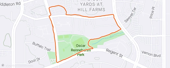
I enjoy walking in Rennebohm Park – the paths are all paved and there are usually quite a few people out walking, or playing soccer or on the tennis courts. Here’s a map showing a typical walk.

Walking route in Rennebohm Park on 2021-02-25

I usually park along Eau Claire Avenue, near the intersection with Sheboygan Avenue. then I walk along Eau Claire Avenue to Regent Street and then head east along Regent to the second paved path. This loops back a bit and then heads east to Segoe Road behind some apartment buildings. Then up Segoe Road to Sheboygan Avenue and back to the car. On this walk I made a little diversion through the American Red Cross parking lot.

This walk was about 1.4 miles. It’s easy to lengthen the walk a little by walking on Door Drive and Buffalo Trail.

Winnequah Park

Winnequah Park is located in the City of Monona on the southeastern side of Lake Monona. The park is fairly large and continas a lot of facilities, including ball fields and outdoor pool. The Monona Library, Community Center and Police Department are adjacent to the park, as is Winnequah Elementary School.

I first became aware of Winnequah Park in the 1990s because it is on the “Lake Loop” bicycle route that goes around Lake Monona. Winnequah Park also hosts the Lake Monona 20 K race in May. I’ve run the race several times, but something odd always seems to happen whenever I run it.

Anyway, here’s a typical walk around the park:

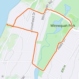
Walking route in Winnequah Park in Monona on 2021-01-11

I usually park in the parking area on Healy Lane near the playground. I typically head south on Healy Lane to Winnequah Road. The basic route is just a loop around the southern part of the park, so I just follow Winnequah Land around until I reach Nichols Road and then return to my car on Healy Lane.

I often make an excursion to one or two of the smaller parks that are nearby. On this occasion I turned left on Wyldhaven Avenue to Wyldhaven Park. It’s a small park with access to Lake Monona and great view of downtown Madison. I then walked on Tonyawatha Trail to Arrowhead Park, which has a playground but not much of a view. I walked down Vogts Lane to Winnequah Road then over to Nichols Road and back to the parking area on Healy Lane.

Depending on the exact route, the walk is between 1.0 and 1.4 miles. It’s mostly flat but it is uphill towards both Wyldhaven and Arrowhead parks.

Esther Beach

Esther Beach Park is located on the south shore of Lake Monona in Madison. It has a nice beach and a new shelter house (constructed in 2018) and a pretty amazing view of downtown Madison across the lake. The official address of the park is 2802 Waunona Way.

There’s not much to say about the park itself; it’s really a pretty small park and it’s all about the beach. It’s kind of like Spring Harbor Beach Park on Lake Mendota.

Here is my usual walking route:

Route map of Esther Beach PArk and the surrounding area

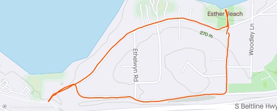
Walking route in the Esther Beach area on 2020-12-07

I park in the small lot at Esther Beach when possible, but sometimes it’s just easier to park on Esther Beach Road. I head up Esther Beach Road towards the Beltline and then turn right onto Nana Lane. I continue on Nana Lane past Ethelwyn Road, and which point Nana Lane magically becomes Harriman Lane. I have no idea why the name changes at this point. I follow Harriman Lane to the intersection with Waunona Way. I usually will turn left and walk to the end of Waunona Way and then onto the Capital City Bike Path for a bit. Then I turn around and head back to Esther Beach on Waunona Way.

The total walk is about 1.2 or 1.3 miles. It is uphill on Esther Beach Road and the first part of Nana Lane, but otherwise it’s mostly rolling hills along Waunona Way.

Note that Thut Park is located close to this route; it’s along Nana Lane and east of Esther Beach Road.

Wexford Park

Wexford Park is located in the City of Madison, bounded by Westfield Road and Sawmill Road; the official address is 1201 N Westfield Road. It is also connected to Longmeadow Road by a path which leads to Stricker’s Pond Conservancy Park.

The wooded area of the park is between the shelter area and the houses along Longmeadow Road. The paved path from Longmeadow Road winds through the wooded area and intersects with several non-paved paths the go through the woods. The path comes out near the shelter house and it is a little steep as it approaches the shelter, so bike riders should be careful  when heading down the hill.

Here is a typical walk in Wexford Park:

Route map of Wexford Park and the surrounding area

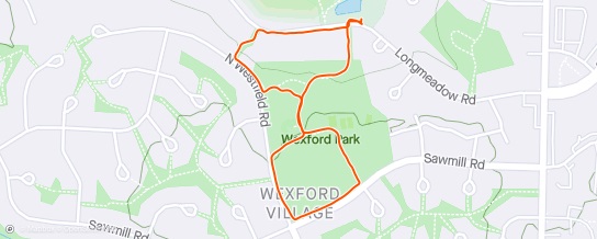
Walking route in Wexford Park on 2020-12-04

I park along Longmeadow Road in the same area where I park when walking around Stricker’s Pond. I head up the Wexford Park Path through the woods to the shelter area, and at the split in the paved path I turn left and walk to Sawmill Road. Then I turn right and follow Sawmill to the intersection with Westfield Road where I again turn right. I continue until I reach the path and head back towards the shelter and playground area. I turn left to go back down the paved path into the woods, but I turn left again at the first non-paved path. I follow this through the woods until I get back to Westfield Road. Then I just continue on the road until I reach another paved path that leads back to Longmeadow Road, and then it’s just back to the car.

The total walk is just over a mile, but it could easily be combined with a loop around Stricker’s Pond to make a two mile walk.


Village Park in Waunakee

Village Park is located (officially) at 410 East Main Street in Waunakee. It is sort of bounded by Main Street, Madison Street, Division Street and the Village Center building. Six Mile Creek loops through the park and there are several bridges that cross over it. There is a baseball field, some basketball courts, several playgrounds, a gazebo and a shelter. It’s a really nice park, with paved paths.

On the other side of Madison Street from the Village Center (and on the other side of the railroad tracks) is the Village Center Pond. This was created by the Rotary Club and it has a nice unpaved path all the way around the pond. There is only one access road to the pond that runs along the cemetery next to St. John the Baptist church and school, however I believe that there is at least one path that leads to the neighborhood south of the pond.

I’ve been coming to Village Park for many years because this is where the Waunafest 5 K and 10 mile races are held in July.

Here is one of my usual walks around the pond and through the park:

Route map of Village Park and surroundings

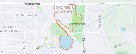
Walking route in Waunakee on 2020-11-20

I usually park near the Village Center along Madison Street or in the Village Center lot. I then walk up Madison Street and turn onto 3rd Street to reach the pond access road. I usually walk around the pond clockwise. Not sure why I always seem to go clockwise, but there it is. The pond is really nice, except in August when the algae turn it bright green. Once I’ve done the loop around the pond I head back toward Madison Street and head towards Main Street. I often take one of the cross streets over to Bacon Street and then follow Bacon to Main Street. Then I walk down Main to the park and I usually turn in by the shelter and follow the drive through the park to the Village Center. And from there I head to Madison Street and back to the car. This particular route was about 1.5 miles, but it’s easy to make it longer or shorter.

  • Waunakee Parks on the Chamber of Commerce web site
  • Village Park (Village of Waunakee web site)
  • Waunafest – note that Waunafest is held in Centennial Park, but the runs and some of the events are held in Village Park.
  • Waunafest Run web site
  • My results from running in the Waunafest races over the years

Stricker’s Pond

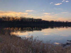
Stricker's Pond on November 6, 2020

Stricker’s Pond on November 6, 2020

Stricker’s Pond straddles the border between the cities of Madison and Middleton. It is one of the kettle ponds in Middleton and on the west side of Madison that were formed during the last Ice Age. I’m not really sure how long it has been a park or conservancy in either of the two cities.

The official address of the Madison park is 7214 Longmeadow Road, and the neighborhood park in Middleton is at 7605 Voss Parkway.

The pond has really suffered over the years, with so much development around it, a lot of water runs off and int the pond. This has caused some flooding issues during major rainfall events, like we had in August 2018. Also, invasive species have causes problems in the conservancy, though volunteers are working to remove invasive plants. Unfortunately, there will be no easy way to get rid of the goldfish which inhabit the pond itself!

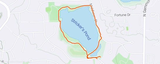
Here is my usual walk around the pond:

Route map of Stricker's Pond

Walking route at Stricker’s Pond on 2020-11-06

I typically park along Longmeadow Road and proceed around the pond clockwise. The path from the road to Stricker Park on the northwest side of the pond is not paved. It’s basically a dirt path although some sections are gravel. At Stricker Park there is a (mostly) paved path that loops around the park area. Along the north side of the pond is wide a gravel path that connects with Middleton Street on the east side of the park. From there I typically walk on the street until I reach the dead end, and then I take the paved path back to the start. It’s about 1.1 miles all together, though doing the full loop around Stricker Park would add to the mileage.

Lakeview Park

Lakeview Park in Middleton is located on Allen Boulevard and Mendota Avenue. It is the largest park in the City of Middleton and has facilities for baseball, tennis and disc golf. It also has a splash pad that is open in the summer, along with play equipment. A Veterans Memorial has been added on the Allen Boulevard side of the par in the last few years.

The parking lots are accessible from the Mendota Avenue side of the park; the main parking lot is at the intersection with N Gateway Street. This is the parking area that is most convenient for the park shelter and tennis courts. The shelter house was completely remodeled in 2020.

There are a number of paths in the park and almost all of them are paved.

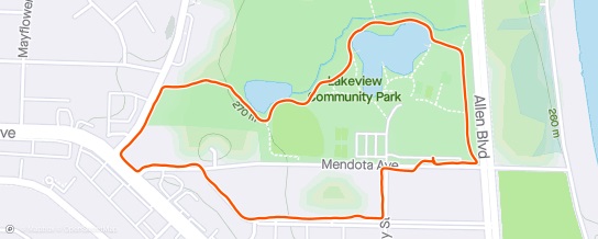
Route Map in Lakeview Park

Walking Route in Lakeview Park on 2020-11-09

I typically start my walk at the new parking lot near the corner of Allen Boulevard and Mendota Avenue. I walk on the path along Allen Boulevard and then follow the path towards the pond, past the baseball complex and the second small pond to the disc gold area. The path then heads past Sauk Trail School up to Branch Street. I follow Branch Street to Mendota Ave. Sometimes I walk straight down Mendota Avenue to the parking lot, but occasionally I walk over to Lakeview Boulevard before returning to the parking area.

Garner Park

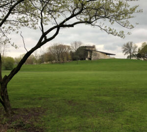
Garner Park on May 10, 2020

Garner Park on May 10, 2020

Garner Park is one of the City of Madison’s parks. It’s officially located at 333 S. Rosa Road. The park is bounded by Rosa Road, South Hill Drive, Whitney Way and Mineral Point Road. The park was created in 1965 or so, but the distinctive shelter house was not completed until 1976.

The parking lot is located off of Rosa Road near the intersection with Mineral Point Road.

The park is home to the annual Opera in the Park, which is hosted by the Madison Opera.

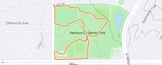
I enjoy walking on the paths at Garner Park. Most of the paths are paved, though there are a few that are just grass. Here is a map of one of my typical walks:

Route Map in Garner Park

Walking route in Garner Park on 2020-11-18

I typically walk past the shelter  and the tennis courts towards South Hill Drive and then walk over to Rosa Road and then take the path below the shelter back toward the tennis courts. There are some basketball courts just off of Rosa Road (across from Driftwood Avenue) where the path across the open field begins. This is typically where most people enter the park for Opera in the Park.